Learn to
Make a Map
with ArcGIS® Pro
REGARDLESS of Experience
Perfect for Emergency Responders, Government Agencies, Engineers, Planners, Scientists...
almost every industry uses GIS
The Basics of
ArcGIS® Pro

"I want to say thank you! Your course has been fantastic — I’ve been able to create data, import information from Excel, and make a map. Thank you again for your time and for creating such a great learning experience!"
-Michael C.
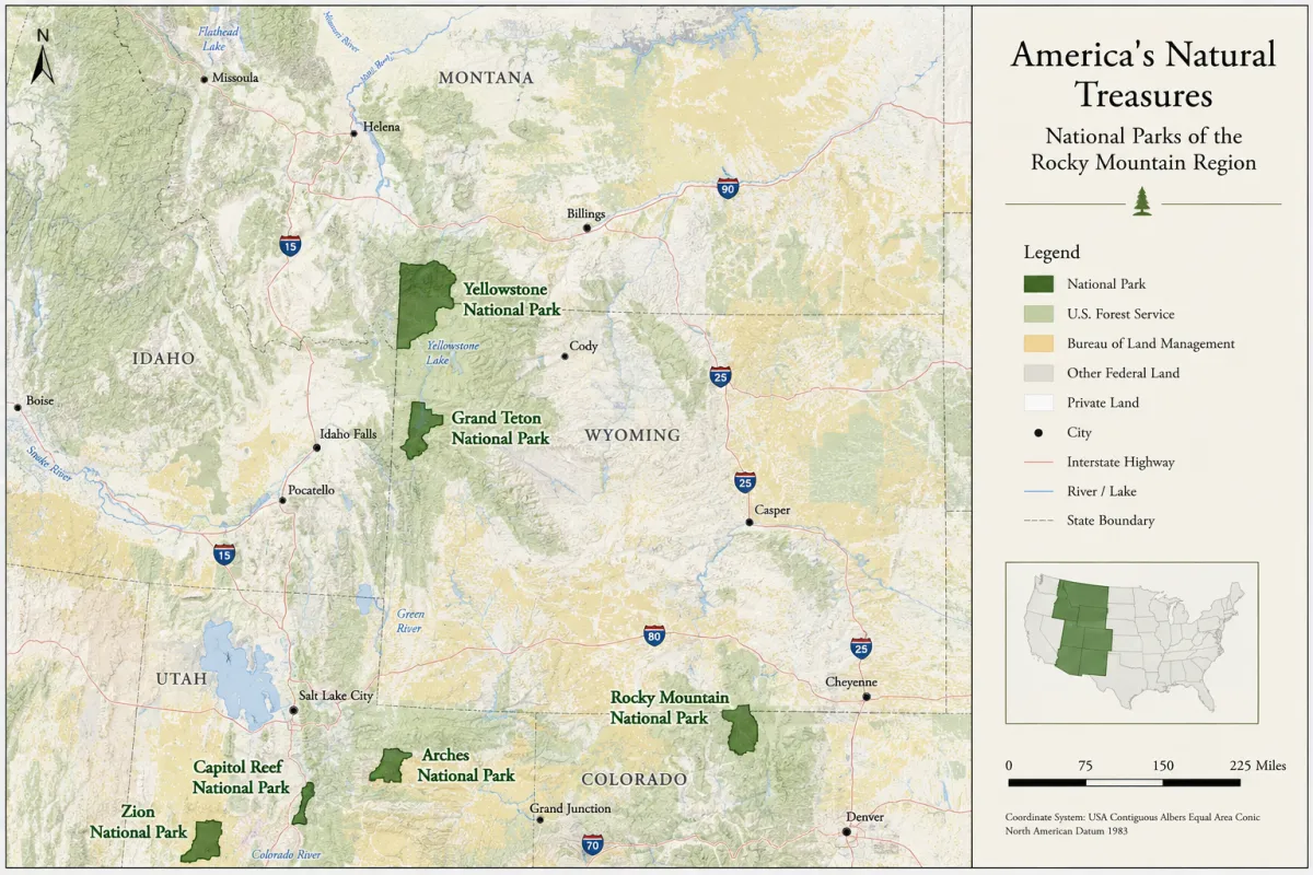
Data Visualization
Transform raw datasets into effective, professional maps.
Real-World Training
Apply your learning immediately by mapping real-world scenarios from scratch.
Career & Academic Advancement
Stand out with highly sought-after mapping and spatial analysis skills to help build a professional GIS portfolio.
Lifetime Access
Learn at your own pace and revisit course materials, datasets, and updates forever without restrictions.
COURSE
Breakdown
This course offers step-by-step video instruction that is simple to follow. Most people get through the entire course in under one day.
You will need an active ArcGIS Pro license because this is an instructional course only. Esri offers an affordable personal/student license if you don't have one through work!
A Geographic Information System (GIS) captures, stores, analyzes, and displays all types of geographical data. In simple terms, GIS is used to evaluate data and make a map.
ArcGIS Pro is the most commonly used GIS desktop software world-wide. The Basics of ArcGIS Pro is a step by step guideline designed to teach beginners how to make a map.
The course assumes zero experience, so if you're new to ArcGIS, this is exactly where to start.
Lesson 1: Open ArcGIS Pro
Create a mapping project and learn to navigate the interface with confidence - even if it's for the first time!
Lesson 2: Create and Manage Data
Import real-world coordinates from a table, create a dataset, and organize your spatial layers.
Lesson 3: Spatial Analysis
Run geoprocessing tools, buffers, and other commonly used data editing functions.
Lesson 4: Visualization
Create and design a professional map that communicates effectively.
Lesson 5: Share Your Map with Others
Export map products as digital files (PDF, JPEG) or share online.
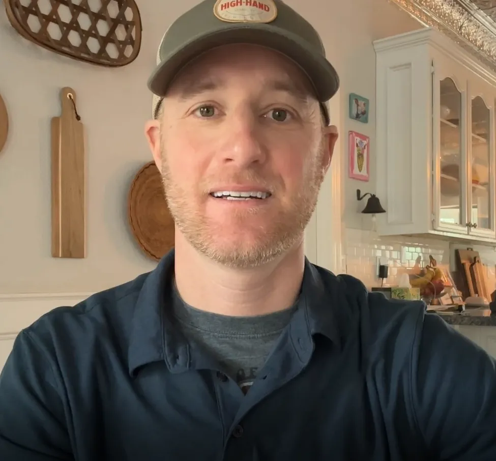
MEET YOUR INSTRUCTOR - Matt Fremont
Learn From A Pro
With over twenty years of experience providing geospatial solutions and teaching GIS, I've seen firsthand how intimidating ArcGIS Pro can feel when you're just starting out. That's exactly why I created The Basics of ArcGIS Pro.
My goal is to strip away the overwhelming technical jargon and focus on the exact, practical workflows you need to confidently create professional-grade maps from day one.
Cartographer / National Geographic Society
GIS Analyst
Professor of Geography
20+ years of Geographic Information Systems experience
500+ satisfied students
STUDENT SUCCESS
"I just wanted to share that I’ve always been interested in GIS but hadn’t found a course that truly captured my attention, until now. Your course has genuinely inspired me to keep learning more. I can’t thank you enough!"
-Catherine K.
"Finally, a course that speaks to beginners and without using a lot of jargon. The course is simple to follow and the hands-on projects gave me the confidence to apply for a GIS Analyst role...and I got it!
-Markus L.
Unlock Your Mapping Potential

Get instant access to The Basics of ArcGIS Pro and start building professional-grade maps today.
The Basics of ArcGIS® Pro Enrollment
$67
One-time payment. Lifetime access.
Perfect for true beginners and people transitioning from ArcMap.
Step-by-step video tutorials.
Real-world datasets.
Personal interaction with our instructor.
Learn at your own pace, wherever and whenever you want to!

30-Day Money-Back Guarantee
Enroll risk-free today. If you're not fully satisfied, get a full refund.
Secure, encrypted checkout. SSL protected.
Your Questions, Answered
Do I need my own ArcGIS Pro software?
Yes, you will need an active ArcGIS Pro license. Esri offers an affordable personal/student license if you don't have one through work!
How long do I have access to the program and when does it start?
You can access this course online right away, and the access date will not expire. Use the course at your own pace from your home or from work...or from anywhere!
Can't I learn all of this on YouTube?
YouTube can be a great resource for stand-alone, individual videos on a specific topic. But, YouTube videos lack the comprehensive approach of this course as well as ongoing, personal interaction.
How long does it take to complete the course?
It takes most people under one day, but you can learn at your own pace. There are 5 lessons approximately 10-25 minutes each.
Ready to Start?
© 2026 FEC, Inc. All rights reserved.